Define the use
Confirm the site, audience, desired output, and level of accuracy the work requires.
Mapping & photogrammetry
A planned mapping flight can create a broader, location-aware view of a property for communication, progress records, planning context, and visual reference. The useful output depends on what the project actually needs to answer.
More than an overhead photograph
A normal aerial image is one perspective. Photogrammetry uses many overlapping images to reconstruct a connected site view or model. That distinction matters when the goal is to understand relationships across a property instead of simply seeing it from above.
ECM scopes the capture, processing, and export around the intended use—then labels the result accurately rather than treating every overhead image as a map.
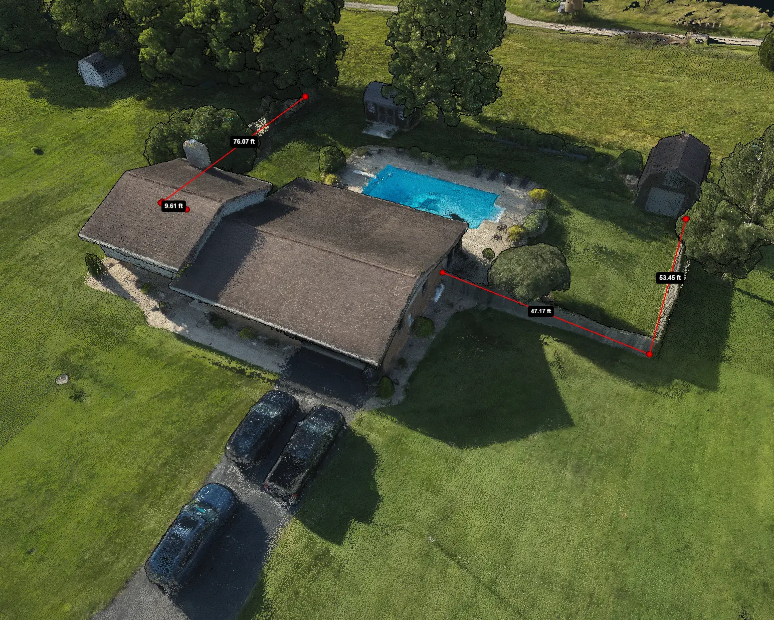
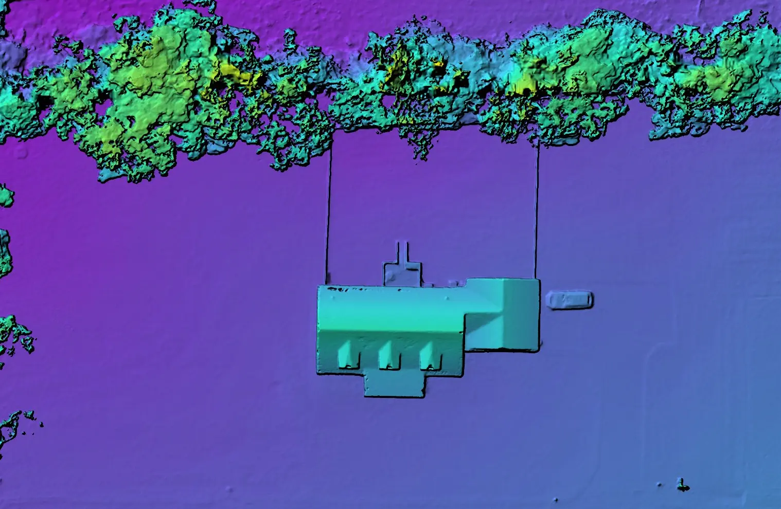
Real output examples
These examples show two genuine ECM outputs. They are useful proof of capability today, with additional map examples to be added as the portfolio grows.
How mapping work is structured
Mapping quality begins before takeoff. Site conditions, coverage, overlap, altitude, control, vegetation, and the requested output all influence the result.
Confirm the site, audience, desired output, and level of accuracy the work requires.
Set coverage, altitude, overlap, flight pattern, and any ground-control requirements.
Build the selected output, inspect coverage, and identify limitations before delivery.
Return the useful visual exports with clear naming, dates, and project context.
Common uses
Give stakeholders one connected visual reference for the broader project area.
Support discussion with current imagery of visible site conditions and layout.
Repeat capture can preserve a comparable visual record across selected dates.
Replace scattered frames with a more understandable reference for the whole site.
Discuss the site
We’ll determine the appropriate capture plan, processing output, and delivery format for the intended use.